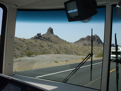
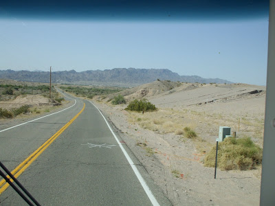
Texas’ largest city stood in our path as we headed east from San Antonio. We considered going out of our way to get around Houston, but decided to just put the pedal to the metal, close our eyes and follow I-10 right through the middle. It was a nail-biting white-knuckle experience. Major freeway development was going on everywhere, highways were torn up and detours zig-zagged around miles of orange cones and rows of Jersey barriers. Obstructions narrowed the traffic lanes and we were constantly pushed and squeezed by 18-wheelers and lots of traffic trying to go faster than it should. We made it through with a sigh of relief and continued on down the highway. The posted speed limit on Interstate-10 across most of Texas is 80 mph. I'm sure we irritate many motorists as we amble along at our more fuel-efficient 55-60. No tickets yet for impeding the flow of traffic.
We stumbled upon a very nice little campground on Turtle Bayou, about 40 miles west of Beaumont. It was at the edge of a lush swamp full of birds and animal sounds. The bayou water was a nice milk chocolate brown and the bullfrogs were loud enough to keep us awake at night.


 The gulf was only 40 miles away, so we drove down to the beach at High Island and did some wading, bird watching and shell collecting. Parking was allowed on the beach so, of course, Ron managed to get the Honda stuck in some dry sand. We dug a couple trenches with our ice scraper (we knew it would come in handy) and were able get ourselves out. It was a bit of a concern having the car stuck in the sand 20 feet from the surf and not knowing if the tide was going in or out.
  The Anahuac Nat’l. Wildlife Refuge was nearby, so we did a walking and driving tour of a small part of the area. It’s a birder’s paradise. But, even more exciting for us, were the alligators that also reside in the refuge. We saw eight or ten gators in their natural habitat, which was one of Bonnie’s primary objectives. Pretty exciting.
 We drove to the end of the Bolivar Peninsula, ate a couple excellent burgers at Crystal Beach, visited old Fort Travis and looked at Galveston across the water. A free ferry could have taken us across but we had no reason to go there and it was getting late.
The Bolivar Peninsula is a long low sand bar that’s fairly well populated but prone to periodic destruction. It has been hit by hurricanes and tidal surges over the years so now all new houses are being built on stilts, some of them so high that we wondered if they are protecting against flooding or trying to get a view over other stilt houses closer to the beach. It’s comical. The peninsula was interesting, but not a place we’d want to live.


 “Fiesta” in San Antonio is all about food, music and fun and it’s all over town. Market Square is the venue for Fiesta Fantasias. The market is a maze of small shops stuffed with everything from Mexican sombreros, pottery and wierd skeleton people to very fine (and expensive) art. Lots of good food was available at street booths and several stages were alive with local Tejano music and some dancing in the streets. We did a lot of walking, looking and sampling of gordidas and mini-tacos. Excellent!!!


 Different bands took the stage and a local belly dancing group did a show as well. Ron especially liked the rough raspy jerky zydeco music that makes you want to dance right out of your chair. Since we know very little about that style, each song sounded pretty much like the one before. It would help if they'd sing the words in English instead of French. But it's a cultural thing and, since music is a universal language, nobody seemed to care. We’re looking forward to some slightly softer Cajun music in Louisiana.


 Four other missions have been preserved as part of the San Antonio Missions Nat’l. Historical Park. We visited two of them. The following two pictures are of Mission Concepcion. The third is the famous "Rose Window" at Mission San Jose (long story).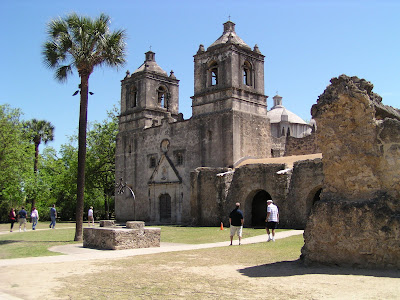


 We spent one night about 20 mi. west of El Paso and had a terrific front window view of the quiet desert, a few birds and a jackrabbit or two (see photo). The campground hostess knew nothing about the area, but we stumbled onto a very good Mexican dinner at a local truck stop restaurant.


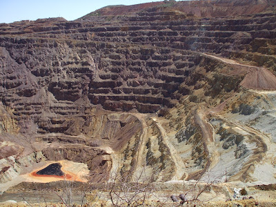


 The old buildings and boardwalks along several blocks of Allen Street of the original town are preserved. The Bird Cage Theater is the most historic and notorious of the structures. It remains largely as it was when it closed. We toured the building, peeked into the basement bordello rooms, saw the bar and card room, and studied the large assortment of memorabilia and artifacts that occupy the main floor of the theater. We were informed that this is considered the most haunted building in the U.S., although we didn’t experience any ghosts in the middle of the afternoon.


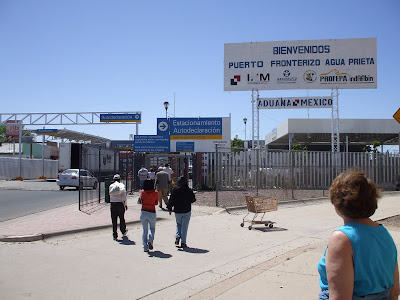 Agua Prieta wasn’t nearly as pretty as its name but the people were friendly, there were a few sidewalk food vendors and lots of interesting businesses. We walked several blocks into town and poked around in a few stores.
  We purchased a few small souvenirs before returning to the U.S. We were armed with driver’s licenses, passports and other picture ID, but weren’t asked for anything. The border guard just looked at us, smiled and waved us through. I guess we’re too obviously American tourists. Maybe the Hawaiian shirt, shorts, funny Dakota farm hat and camera around the neck gave it away. It was just too easy!!!